The location intelligence market reached an estimated $24.70 billion in 2025 and is projected to climb to $53.62 billion by 2030. Buyers in this category range from a one-person sales team plotting accounts on a map to a 5,000-employee insurance carrier modeling flood risk against policy density. The right tool depends on the use case, data scale, and available technical staff. The eight products below cover most of the practical buying decisions a company will face in 2026.
Criteria for the List
The selection focused on five attributes. Coverage of core location intelligence features such as geocoding, mapping, territory analysis, and routing. Active product development and recent feature releases. Pricing transparency or at least public benchmarks. Stable user reviews on independent platforms. Real customer references in published case studies. Pure GIS authoring tools without business workflows were excluded, as were single-purpose mobile apps that do not handle CSV uploads of customer data.
1. Maptive
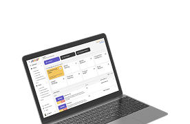
Maptive targets the gap between a free Google My Maps account and an enterprise GIS deployment. The product handles CSV upload, automatic geocoding, heat maps, territory creation, and route optimization without requiring dedicated GIS staff. Pricing follows a per-user subscription model with annual discounts. The platform suits sales teams, marketing departments, and operations groups that need a working mapping environment within a few hours of signup. Larger firms with custom analytical needs typically pair Maptive with a CRM rather than asking it to replace one.
2. Mapbox
Mapbox sits at the developer end of the market. Its strength is custom map rendering with full design control, available through APIs that engineering teams build into their own applications. The tool is less a finished product and more a set of building blocks. Mapbox is the right choice for a company shipping a customer-facing app with maps in it. It is the wrong choice for a marketing analyst who wants to upload a CSV and produce a dashboard the same afternoon.
3. CARTO
CARTO, which raised a $61 million Series C round in late 2021, offers cloud-native location intelligence built for analyst workflows that touch large datasets. Its integration with cloud data warehouses such as Snowflake and BigQuery means that a 100-million-row dataset can be queried directly without moving the data into a mapping tool. CARTO suits data teams that already work in SQL and want spatial analysis layered on top. Pricing matches enterprise data tools rather than mid-market mapping software.
4. ArcGIS
ArcGIS is the legacy benchmark for enterprise geographic information systems. The platform handles every common spatial workflow and many uncommon ones, with a deep ecosystem of data, training, and integration options. Pricing scales with usage and complexity, and full deployment usually requires dedicated GIS staff. ArcGIS suits firms running heavy spatial analysis as a core function, including retail real estate, public utilities, and government planning agencies. Smaller teams often find the price and learning curve out of proportion to their actual needs.
5. Tableau
Tableau, the Salesforce acquisition target bought for $15.7 billion in 2019, brings location intelligence inside a wider business intelligence platform. The mapping features are good enough for most regional analysis and benefit from the rest of the Tableau dashboard environment. Companies already invested in Tableau for general analytics often add the mapping module rather than buy a standalone tool. Tableau is less suited to deep route analysis or territory optimization, where dedicated mapping products do more.
6. Microsoft Power BI
Power BI, now part of Microsoft Fabric since the 2023 launch of the unified analytics platform, ships with built-in map visuals that draw from Bing Maps and Esri layers. Organizations with existing Microsoft licensing get location intelligence at low marginal cost, which makes Power BI a default starting point even for teams that eventually outgrow it. The map visualizations are adequate for executive dashboards but offer less depth than purpose-built mapping software when the underlying analysis needs to drive a sales territory or service area decision.
7. eSpatial
eSpatial focuses on sales territory mapping and route planning for field teams. The product is more focused than the general-purpose tools above, and the focus shows in the workflow design. Territory creation, balancing, and assignment occur within features built for that exact task, rather than being adapted from general mapping. eSpatial suits firms whose primary use case for mapping is sales territory management. Companies with wider requirements may find the breadth limiting.
8. Google Maps Platform
Google Maps Platform offers APIs for geocoding, routing, places, and embedded maps. The pricing model is usage-based, which suits transactional workloads such as ride-sharing or delivery applications. For analysts who want a finished mapping product with a UI, Google Maps Platform is the wrong layer. For developers building location features into their own software, it remains the most widely adopted option in the market.
Choosing Among the Eight
The selection process tracks closely with three questions. What problem are you solving? Sales territory mapping, customer plotting, route optimization, marketing analysis, and risk modeling each favor different products from this list. Who will use it daily? An analyst comfortable in SQL fits CARTO. A field rep without technical training fits eSpatial or Maptive. A marketing manager fits Tableau or Power BI. What systems must integrate? A standalone tool that cannot connect to the company CRM creates manual export work that erodes any productivity gain from the mapping itself.
A pilot of two or three options usually answers the questions faster than a feature-comparison spreadsheet, and it surfaces the workflow gaps that even thorough analyst reviews, such as Forrester’s platforms landscape report, cannot resolve at the level of a single buyer’s daily work. Most vendors offer trials, and the actual user behavior under real workload reveals fit better than a sales demo. Buyers who skip the pilot and select on price alone often return to the market a year later, having learned that the cheap tool failed at the workflow they needed.
The location intelligence market in 2026 contains more capable products than any single team can evaluate. The eight covered above represent the bulk of the realistic shortlist for typical business use cases. Selection comes down to honest scoping of the problem and a short pilot that tests the tool against the work it will do.